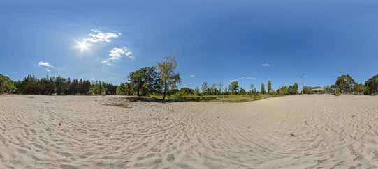
The route of the trail runs through the Kozi Bór Protected Landscape Area in the immediate vicinity of the Kozłowiecki Landscape Park.
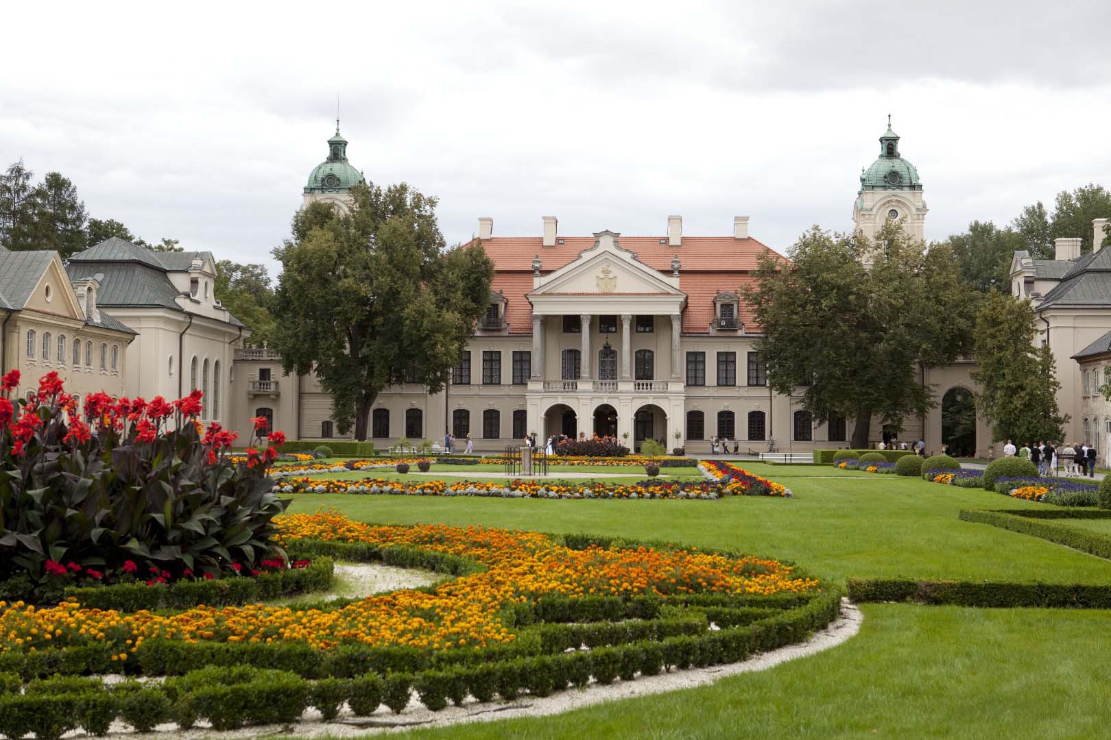
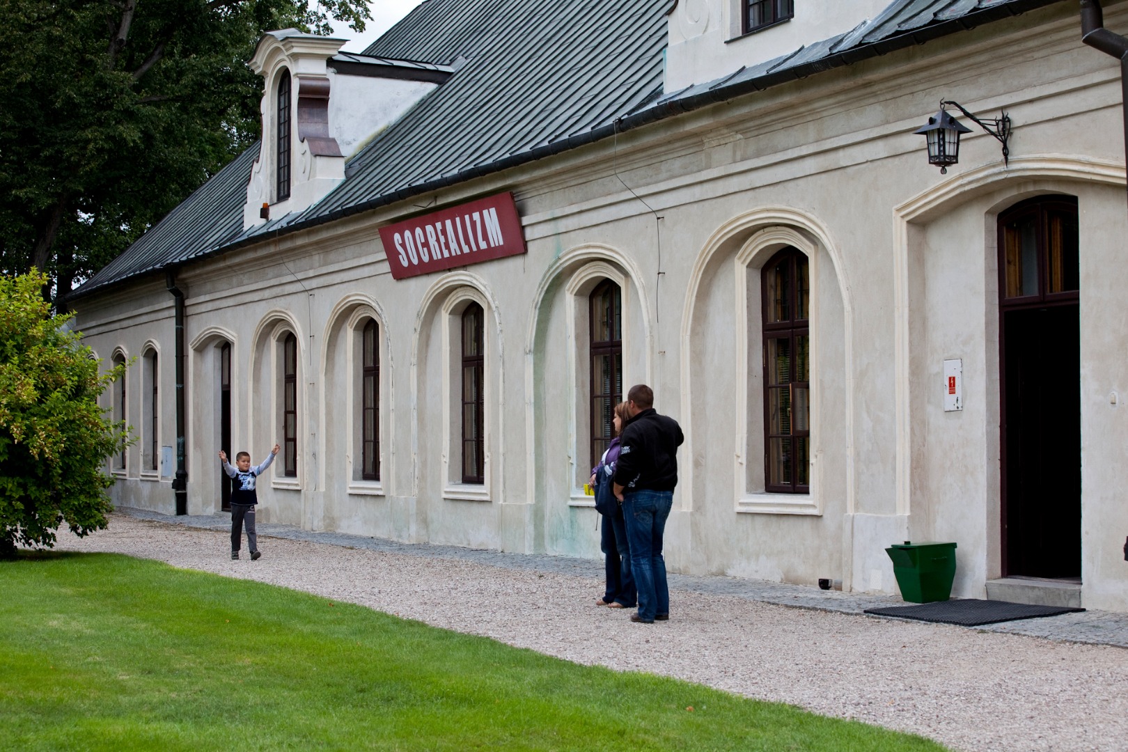
In addition to its landscape assets, the trail also encompasses local historical monuments and sites associated with martyrology, and it presents an interesting history of the development of the local sugar-refinery and buildings associated with it. In the vicinity of the trail, you can visit the Zamoyski Museum in Kozłówka – the best preserved magnate residence in Poland.
Traversing the trail does not require mountain terrain bikes, as most of the route runs on the paved surface roads.
In order to begin the ride along the black trail around Garbów County, you first need to reach it by the red connecting trail that is 2.53 km long. You begin the ride at National Road 17 in the vicinity of the Garbów distillery, following the main asphalt road in the direction of the village of Borków.
The first distillery in the vicinity of Garbów was built in the nearby village of Przybysławice. Bogdan Broniewski purchased both estates in 1904, and rather than renovating the old distillery in Przybysławice, he decided to build a new one instead in Garbów. Its construction was completed in 1906 and 10 years later the front part was expanded to hold a larger container for the so-called neutral grain spirit. After the Second World War, the distillery was nationalized and was managed by State Agricultural Farms. The northern wing was added in the 1960s. At present, the distillery is a private property.
Nearly 2 km later you ride on the overpass above Express Road S17. Less than 700 m behind the overpass, you reach the road sign at which the red connecting trail ends, and the black trail begins. It has the form of a loop; you can now either go straight on or turn left.
Proceeding straight on for 16 km, you will reach the village of Meszno. You turn right and enter the yellow connecting trail leading toward the village of Kozłówka. Proceeding straight on all the time along the yellow connecting trail (that is 7.31 km long), and then following the Kamionka County section of the blue trail ( 3 km), will take you directly to the gate of the Zamoyski Museum in Kozłówka. The total distance from this point to Kozłówka is about 26 km. In order to traverse the route, you need an all-terrain bike, suitable for riding on the field and forest roads.
Moreover, about 2.5 km later you have the possibility to go along the red connecting trail (that is 2.8 km long) to get to the blue trail around the northern part of Jastków County, or you can follow the yellow connecting trail (that is about 1.8 km long) to reach the green trail around Niemce County.
You are 3 km away from the green trail around the southern part of Garbów County. You can reach it proceeding along the red connecting trail that you have followed to get to your current location.
You continue straight on and after 1.2 km you turn right onto the main asphalt road. You then head toward the village of Leśce. 1.4 km later you go under the overhead power lines and turn right (at 5.13 km). You ride through the village of Karolin and you turn left at the millennium cross (at 6.42 km). According to its inscription, the cross is meant to advise the future generations on how to find the way to God. Here, on the bicycle route, it points out the further direction of the ride. You pass by the roadside lindens, and then you cross the concrete culvert above one of the streams that is a tributary of the Kurówka River, which begins its course nearby (at 6.97 km).
The Kurówka River, a right-bank tributary of the Vistula River, is ca. 45 km long. The Kurówka River has its source in the following three springs located within Garbów County: Piotrowice Wielkie, Bogucin, and Piotrowice-Kolonia. The mouth of the river is located within the borders of Puławy. The Kurówka River flows through Garbów, Markuszów, Kurów, Końskowola and Puławy. The area of its basin is 395.4 km².
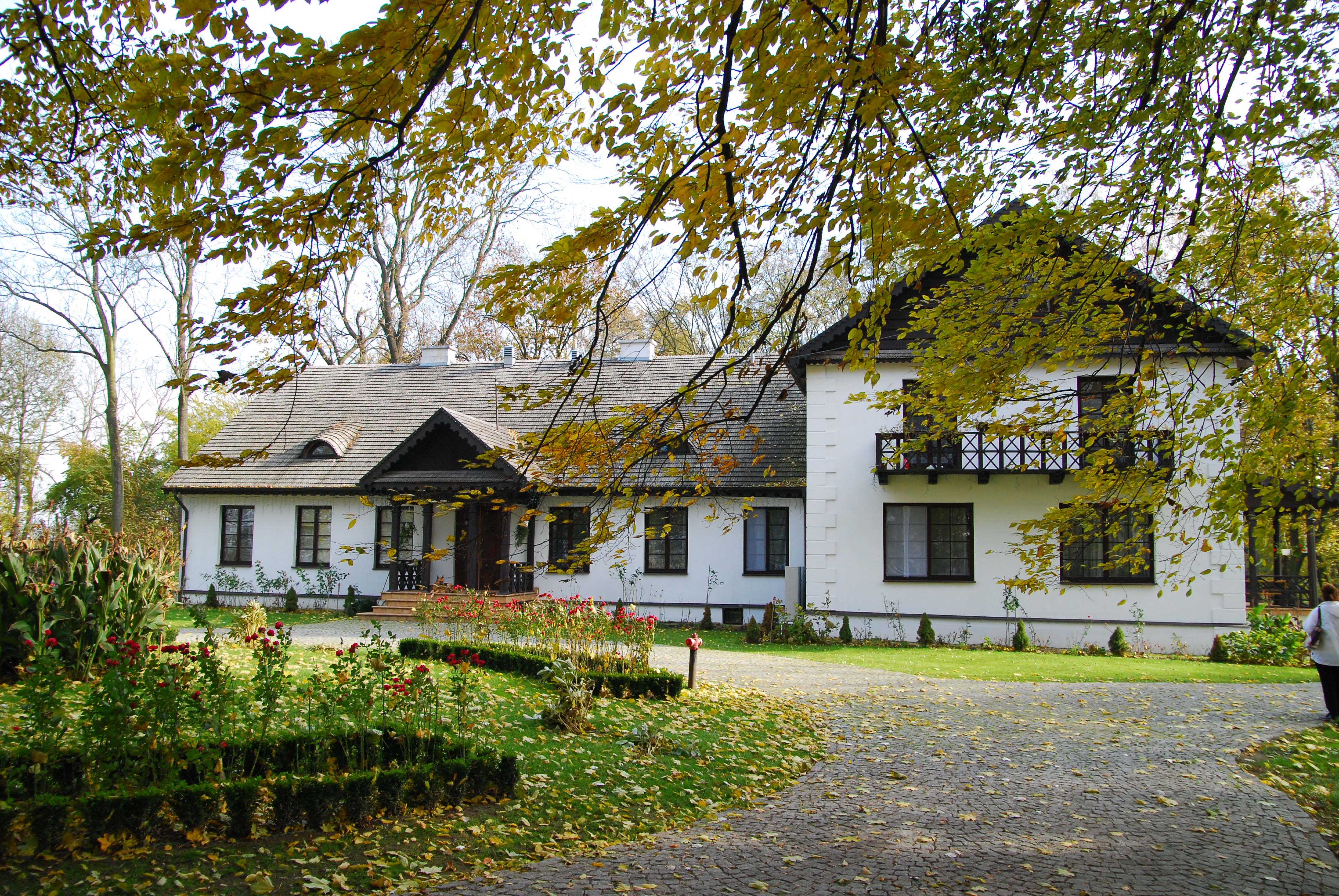
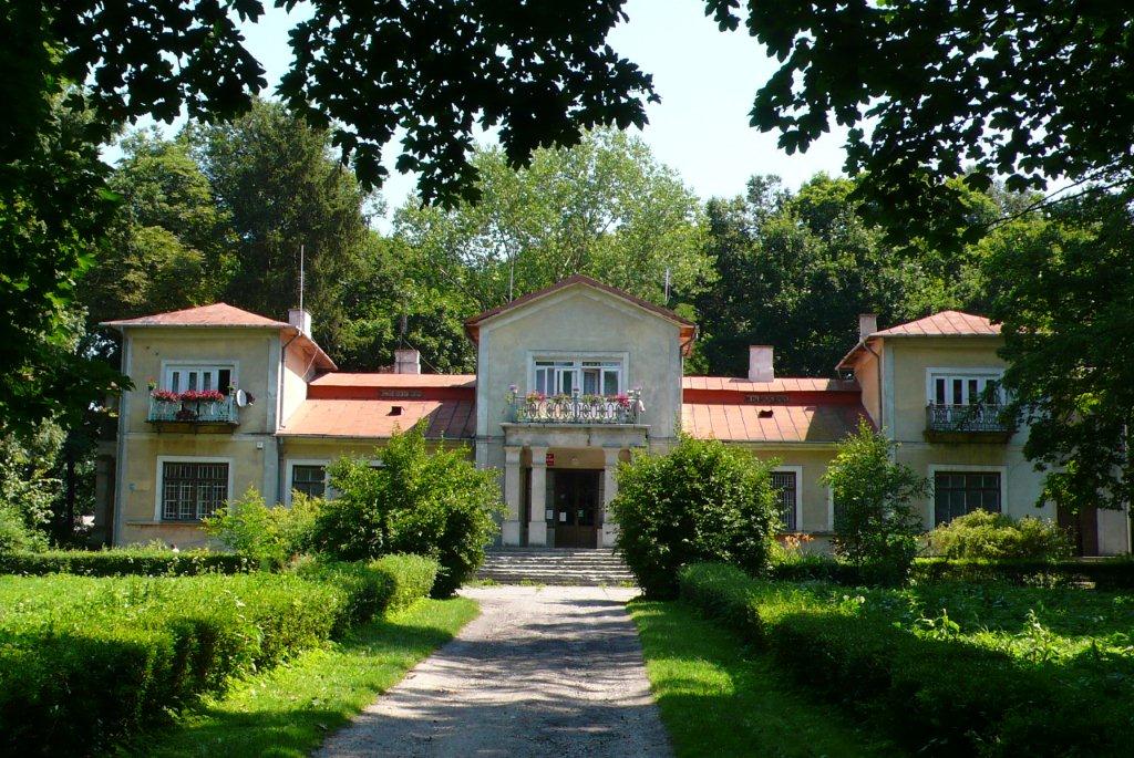
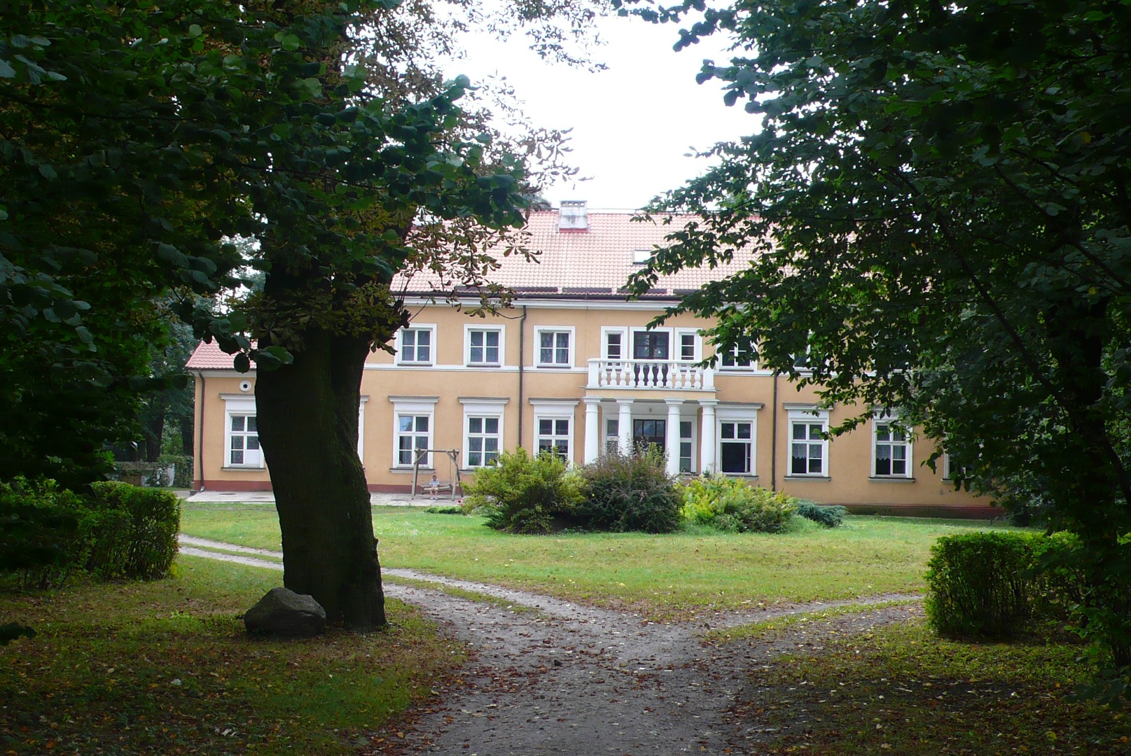
You leave the asphalt road, turning right at the large linden with a metal cross underneath (at 7.33 km). You continue on the field road with parallel overhead power lines and reach the gate leading to the Manor in Leśce surrounded by a park (at 7.61 km). You can see from here the larch building covered with the shingled roof, with the picturesque hornbeam alley in front.
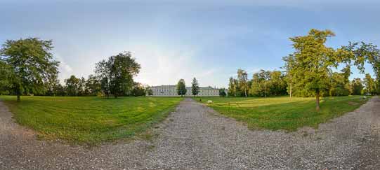
One of the owners of the estate in Leśce, Dionizy Trzciński of the Rawicz Coat of Arms, decided to build a new residence next to the existing manor. The construction of the beautiful larch building was completed in 1855. The farm buildings were expanded together with the manor. In the spring of 1915, during the First World War, most of the farm buildings burnt down, but fortunately, the manor was spared. In the interwar period, the estate was systematically renovated. Nationalized after the Second World War, the manor gradually deteriorated. Soon after the war, the ground floor of the northern wing with the kitchen was demolished. The local school began using the building in this limited form. In 2000 private owners purchased and overhauled the manor, in an attempt to return the residence and its surroundings to their former glory. The renovated building serves as a venue for conferences, training events, and banquets.
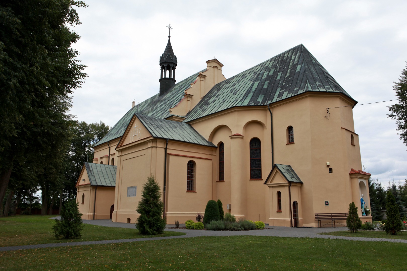
Before setting off again, have a look at the slender towers of the parish church in Garbów that are visible in the distance on the right. You continue along the park fence, turn left and reach the asphalt road (at 7.79 km). After about 140 m you pass by the southern gate of the manor-park complex and enter the village of Leśce. More or less one kilometre later the quality of the asphalt road deteriorates, as many holes appear for about 2 km, so please be careful when riding a bicycle.
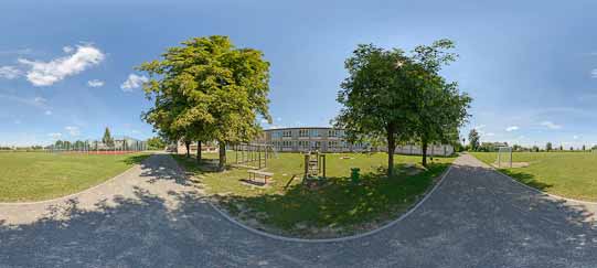
The route of the trail takes you by the Zofia Trzcińska-Kamińska Elementary School. The school’s patron is a famous sculptor, the daughter of Witold Trzciński, owner of the estate in Leśce.
Zofia Trzcińska-Kamińska (1890–1977) was an eminent sculpting artist, who spent her childhood and youth in Leśce. She sculpted in wood, stone, and marble. She eagerly sculpted the portraits of her contemporaries, as well as of historical figures. She also did bas-reliefs, medals, statues and monuments. Zofia Trzcińska-Kamińska’s works are featured in over 70 churches and monastery chapels, in Warsaw, Kraków, Tyniec, Katowice, Toruń, Płock, Szczecin, Łódź, Łomża, and Lublin, among others. Trzcińska-Kamińska’s sculptures are also exhibited at the National Museum in Warsaw, the Polish Army Museum and the Museum of the Kielce Land. They are also part of collections abroad: the Vatican collections, museums in Budapest and Chicago, and are in private collections in France and England. Almost all significant museums of Europe boast her medallic works.
The artist made the following sculptures for the Garbów church: the Stations of the Cross, the figure of Our Lady the Queen of the Crown of Poland (Our Lady in a folk costume shows the emblem of Poland leaning on the oak stump with new sprouts covered with fresh leaves growing out of it to Baby Jesus), the statue of Madonna with the rosary in her hand (placed at the high altar), and the statue of Christ the King (at the church’s fronton). Also noteworthy is the family tomb in the shape of a cube at the old Garbów cemetery, featuring the bas-relief ornamented with the motif of the Crucified Jesus Christ.
You ride on and after 420 m you reach the intersection, where you turn left at the slender wooden cross (at 9.29 km).
According to the signpost placed here, if you proceed straight on along the yellow connecting trail that starts here, after 5 km you will reach the green trail around Niemce County. Another signpost with a trail map, located nearby, suggests that if you turn right at the intersection and then follow the red connecting trail that is 2.8 km long, you will reach the blue trail around the northern part of Jastków County.
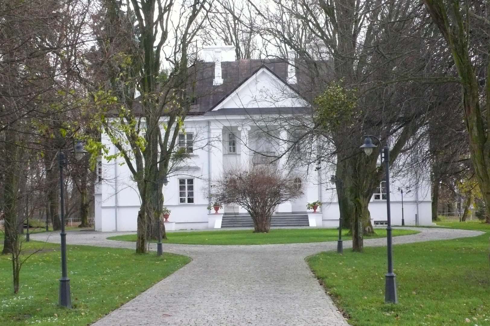
If you turn right behind the markers of the red connecting trail, you can reach an interesting park-palace complex in Piotrowice Wielkie (at 1.5 km).
The manor was erected after 1899 by Ludwik Budzisław Kopeć. Some of the farm buildings were also constructed then, of which only the brick cowshed remained until the present times. The building is surrounded by a naturalist landscape park linked with an orchard located on the southeast. The tree stand is dominated by ashes, horse chestnuts, poplars, maple trees, linden, and hornbeams, with examples of trees in particular species recognized as monuments of nature, and individual magnificent examples of European Larch and English Oak. After the Second World War, the estate together with the manor became property of the State Treasury. Initially, a military unit was located in the manor, and after the 1950s it housed a dairy, a school, and a public library.
When in Piotrowice Wielkie, it is also worth seeing the brick windmill, the so-called smock mill – the only monument of this type in the Lublin Region. Also noteworthy are the historical roadside shrines: the brick shrine with the figure of St. John of Nepomuk dating from the 19th century (standing on the right side of the road leading to the village of Krasienin), and the roadside column shrine from the 19th century with the figure of Madonna with Child, called “Our Lady of the Manor” (it is located at the entrance to the palace), which was most likely founded by the manor’s owner, Ludwik Kopeć. In the village centre at the intersection stands a roadside chapel built in the 19th century, featuring the painting of Our Lady of Częstochowa in the altar. A rest area for cyclists is located at the local Voluntary Fire Department Station.
You return to the intersection to the black trail. 600 m later the asphalt road turns into a concrete road (at 9.94 km). You continue straight on for over 500 m and turn left before the buildings (at 10,51 km) onto the gravel road. After another 500 m, you turn right onto the concrete road near the three lime trees surrounding a small metal cross (at 11.02 km) and ride under the overhead power line. Now, you continue among the forests, passing by solitary buildings. The road turns into a sand road in places, and then it is gravel again. You turn left (at 12.73 km), passing by a brick barn from 1979 and then you turn right at the metal cross (at 12.81 km). This is how you reach the village of Borków.
Watch out for the asphalt road holes, while riding through the village. At the same time, it is worth noting a few old wooden houses standing among the contemporary buildings. On the right, you pass by a stork’s nest (at 13.66 km) behind which the main road becomes more even and then you reach the intersection. You ride straight on (at 13.89 km). Because of the revelries that were once often held at the nearby fire station, the intersection is guarded on one side by a historical roadside chapel and on the other side by a metal cross standing under three lime trees. You pass by the Fireman’s House in Borków and the store, and about 1 km later you leave the village (at 14.83 km) and reach the intersection in Janów, where you turn right (at 15.33 km).
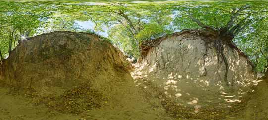
At the crossroads, like in Borków, a roadside chapel faces a cross. Janów features the remnants of the former traditional orchards adjacent to the houses (at 15.76 km). You reach the end of the village. The asphalt road ends at the old wooden cross and turns into a gravel road (at 16.31 km). After about 100 m, at the fork of field roads, you turn left toward the nearby forest (at 16.43 km). Among the trees growing in the vicinity are pines, spruces, hazels, hornbeams, oaks, beeches and birches. In the beginning of the summer you can pick up berries and wild strawberries, while in the autumn – mushrooms (ceps, Boletus, boring brown boletes, chanterelles, and parasol mushrooms). It is also easy to encounter a common buzzard soaring here among the fields.
You turn right before the forest at the solitary abandoned farm (at 16.68 km). Proceeding on the road that is at places sandy, you ride along the old wooden fence at the edge of the forest. Less than 1 km later, you reach an obelisk founded by the residents of the village of Kruk.
The obelisk located among centuries-old oak trees commemorates the execution site of nine residents of the village. On June 4, 1943, the Nazi Germans officers grabbed men above the 15 years of age out of their houses, shot them to death, and burnt down the village. It was a revenge for the assistance the village residents gave to the partisans. The mass grave of the murdered is located in the cemetery in the nearby village of Starościn.
You proceed and soon leave the forest (at 18.09 km) and reach the asphalt road. You turn left behind the roadside cross (at 18.69 km) and reach the village of Meszno. At the intersection (at 18.75 km) you can leave the asphalt road and follow the yellow connecting trail to the village of Kozłówka (the travelling distance is about 10 km).
You turn right and enter the yellow connecting trail. Proceeding along the trail straight on all the time, until the blue trail around Kamionka County, will take you directly to the gate of the Zamoyski Museum in Kozłówka. If you decide to follow this route, you need to have an all-terrain bicycle, suitable for riding on the field and forest roads, as part of the trail runs along such roads. For a detailed description of the course of the trail see p. XXX.
Continuing the ride along the Garbów black trail, you proceed along the asphalt road straight on among the buildings of Meszno. You pass by a small roadside glass shrine with a figure of Madonna (at 19.03 km), and then a characteristic fence with quasi-Indian ornamental motifs (further down in the courtyard you can see two bird totems painted at the garage doors). The main asphalt road meandering among the houses finally reaches the forest. You turn right here (at 19.4 km), and 200 m later, you turn left. You pass by a forest road (at 20.37 km) and after about 1 km the forester’s lodge of the Forest Inspectorate in Wola Przybysławska (at 21.33 km). There you enter the asphalt road again (at 21.42 km). You ride on, passing by the reeds on the left. If you are lucky, you will encounter the western marsh-harriers, which nest in the vicinity in large numbers. You continue straight on at the next crossroads (at 21.78 km) toward the village of Wola Przybysławska.
The village of Wola Przybysławska is one of the largest villages in the vicinity. It was established on the territory of the royal village of Przybysławice in the 16th century. It consists of a few colonies, called districts, including Rafa, Kępa, Granica, Stara Wieś, Stegny, Zakopaniny and Orlicz. Strawberries, tobacco, valerian, grain and potatoes are grown on this land. Numerous meadows enable cattle breeding and milk production.
You pass by a stork’s nest and a small cross standing on the other side of the road (at 23.09 km). It is worth noting tobacco oasts adjacent to houses. The plant requires fine soil and it has been successfully cultivated in the vicinity for many years.
A moment later you reach the elementary school in Wola Przybysławska (at 23.47 km). This is where the black trail is joined by the blue (northern) trail around Markuszów County.
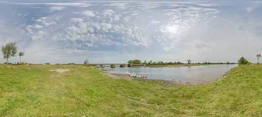
The blue trail that is 13.2 km long runs near two picturesque lakes: Rejowiec and Duży Ług Lakes, and then it leads through the villages of Wólka Kątna and Bobowiska until Markuszów (the detailed description of the course of the trail is on p. XXX). In Bobowiska you can turn right onto the red connecting trail (7.09 km long) that will take you through Kłoda to Kurów to the green trail from Klementowice to Strzyżewice (see p. XXX).
You turn left at the intersection near the school, and after less than 400 m you turn right (at 23.84 km). About 100 m after the turn, you pass by on the left hand side the Voluntary Fire Department Station in Wola Przybysławska, and a school playing field (at 23.97 km). About 200 m later you pass by the former milk depot, which now houses a doctor’s surgery in one of the rooms. Continuing the ride, you pass by two roadside crosses respectively: a metal (at 24.33 km) and a wooden cross (at 24.46 km). Electric fences may be installed in the vicinity, so it is better not to check, whether they are plugged in. After over 700 m, you turn left at the cross standing beneath the maple tree (at 25.2 km).
Informacja w czerwonej ramce
Due to the construction of Express Road S17 the remaining course of the trail can be different than the description below. Furthermore, until the end of the construction, some parts of the trail may be impassable.
Koniec ramki
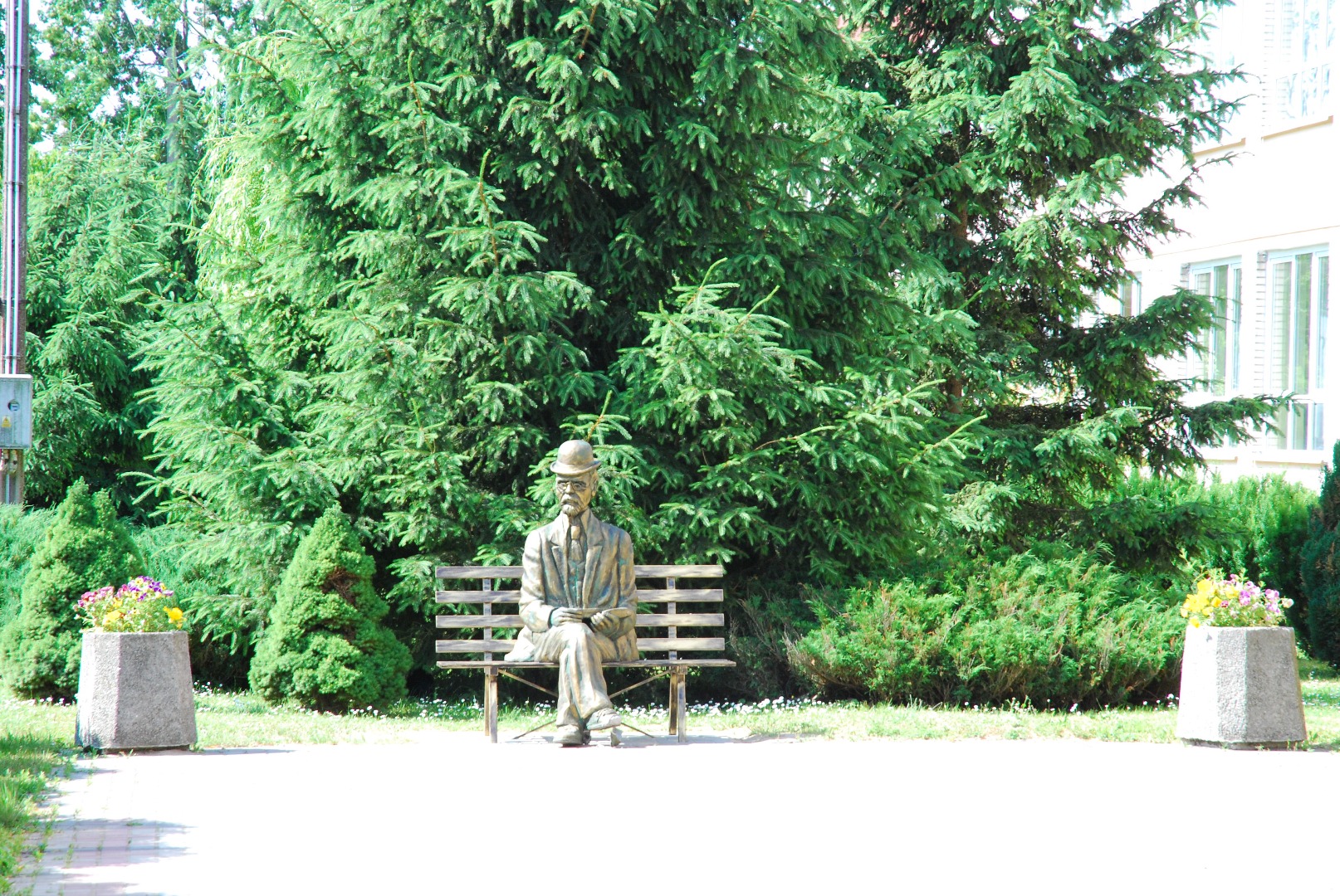
You turn right about 600 m behind the black trail markers and head toward Przybysławice. You proceed straight on all the time; cross Route S17 and about 2 km later you turn left and reach the School Complex in Przybysławice. The school patron is Bolesław Prus, who often visited Przybysławice, and he even used the fate of one of the local peasants as the basis for his novel, Placówka, [Outpost]. A little bench with the figure of the writer, where you can take a souvenir snapshot, is placed in front of the building. The Garbów sugar-refinery operated once near the school, on the other side of Route 17.
The sugar-refinery in Garbów was built in 1904 by industrialist Bohdan Broniewski. It operated for almost one hundred years until 2003. The sugar factory improved the economic situation of the local manors and farmers’ households, and in the course of time it became one of the best sugar-refineries in the Kingdom of Poland. It offered employment for many people, housing for the employees, and it gave assistance and support to the local parish. One of the directors of the refinery, Jan Rupert Łopaciński, supported the establishment of the Primary School in Przybysławice (1926) and the construction of the School of Landowning Girls in Nałęczów. The sugar-refinery operated from its establishment until the end of the Second World War as a joint-stock company. It was nationalized in 1947. During the reprivatization period, it was retrieved in 1996 by the granddaughter of the founder, Maria Gordon-Smith with shareholders. After two years, the refinery was sold to the British Concern Tate & Lyle, and then to the Sűdzucker German Group. The last owners merged the sugar-refineries: “Garbów,” “Przeworsk” and “Łubna” into one company – Małopolska Sugar Joint-Stock Company with the main office in Kazimierza Wielka. In 2003 it was decided to shut down the refinery in Garbów.
The manor-park complex dating from the early 20th century is located behind the buildings of the sugar-refinery.
It is the former neo-Classical Jezierski Family Manor, surrounded by the old growths of trees and ponds. The Broniewski family were the last owners of the manor. After the nationalization of the sugar-refinery that they established in the 1950s, a storey was added to the palace and it was turned into a dormitory for the middle and high school students. Since 1953 until the present day, it has housed an orphanage.
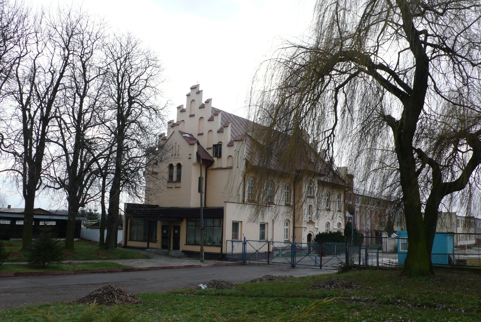
The office of the former director of the sugar-refinery, surrounded by a garden, is located near the school in the village of Zagrody.
The villa in the form of a neo-Classical palace was erected at the request of Bronisław Broniewski and designed by Warsaw architect Tadeusz Zieliński in the years 1918–24. The icehouse (currently turned into a stable) was located next to it. After the war the successive directors of the sugar-refinery and the employees lived there, and the building also housed a kindergarten. At present, the little palace is in private hands. The building was renovated and is now surrounded by a high fence.
The history of the sugar-refinery is inseparably associated with the history of the local narrow-gauge railway that provided the factory with an efficient local transportation and the connection with the world.
The narrow-gauge railway (750 mm track gauge, steam traction) was used as a local, auxiliary transportation that carried products and people. After the construction of the Garbów Sugar-Refinery began, it was necessary to connect it to the broad-gauge railway, Nadwiślańska Railway, running from Warsaw to Lublin. Thanks to the narrow-gauge railroad, the sugar-refinery received transportations of coal, limestone, and it exported sugar, molasses, sugar beet pulp and sugar beets. But the railroad had a very universal usage, too, as it also transported grain, flour, artificial fertilizers, and carried people, thanks to which residents of the entire vicinity could easily get to e.g. Markuszów fairs. The first section of the railroad was established at the same time as the Garbów Sugar-Refinery – the line led from the refinery to the Wąwolnica Station (as of 1925 called Nałęczów) and was 12 km long. In the mid 1920s, the sections toward Bogucin and Kurów were added. The section connecting the sugar-refinery with Bogucin had another three sections added to it that lead to: the sand mine near the village of Marynka, to the distillery and the mill in Garbów, and the offshoot toward the vicinity of the village of Leśce. According to the census of 1926, the sugar-refinery owned 32 km of the narrow-gauge railroad tracks (750 mm) and the rolling stock, including 2 fifty horse power steam locomotives, 2 eighty horse power steam locomotives, 28 five ton cars, and 34 nine ton cards. The narrow-gauge railway reached the Nałęczów Railway Station, and the narrow-gauge railway tracks were located next to the broad-gauge railway, so that the goods could be reloaded directly from one car to another. Since 1916 another narrow-gauge railway with the same gauge track reached the Wąwolnica Station, the present Nadwiślańska Narrow-Gauge Railway. However, because the two narrow-gauge railroads were located on the opposite sides of the Nadwiślańska Railway and were not permanently connected, the rolling stock exchange was carried out with the help of the jetties temporarily placed across the normal track. Unfortunately, the railway network of the Garbów Sugar-Refinery was liquidated in the 1970s. Nowadays, there are still many traces of the narrow-gauge railway visible in many places, mostly embankments and excavations. One of the best-preserved fragments is the embankment along Route 17 between Markuszów and Zagrody. At the same route in Bogucin, you can see the former railway station building (at present, an inn) together with the loading ramp.
You leave the school in Przybysławice behind and proceed parallel to the nearby Route 17. Then, following the trail markers, you leave the village of Zagrody, you go through the Agricultural Cooperative in Wola Przybysławska (Marianka) and you reach the road toward Abramów. You then turn right and after about 500 m you make a sharp turn left. You then proceed along the straight stretch of the road for about 2.1 km, and then cross Route S17 and turn right. After another 400 metres you arrive at the Borków – Garbów road, and this is where the ride along the black trail comes to an end.

It is the former neo-Classical Jezierski Family Manor, surrounded by the old growths of trees and ponds. The Broniewski family were the last owners of the manor. After the nationalization of...
One of the owners of the estate in Leśce, Dionizy Trzciński of the Rawicz Coat of Arms, decided to build a new residence next to the existing manor. The construction of the beautiful larch...
The manor was erected after 1899 by Ludwik Budzisław Kopeć. Some of the farm buildings were also constructed then, of which only the brick cowshed remained until the present times. The...
The blue trail that is 13.2 km long runs near two picturesque lakes: Rejowiec and Duży Ług Lakes, and then it leads through the villages of Wólka Kątna and Bobowiska until Markuszów...
The Kościuszko Rock, was erected on this site on the 100th anniversary of the Supreme Commander’s death, and affixed with the inscription, “Honour to Kościuszko 1817–1917.”...
The Kurówka River, a right-bank tributary of the Vistula River, is ca. 45 km long. The Kurówka River has its source in the following three springs located within Garbów County:...
The sugar-refinery in Garbówwas built in 1904 by industrialist Bohdan Broniewski. It operated for almost one hundred years until 2003. The sugar factory improved the economic situation...
The village of Wola Przybysławska is one of the largest villages in the vicinity. It was established on the territory of the royal village of Przybysławice in the 16th century. It consists of a few...
The blue trail that is 13.2 km long runs near two picturesque lakes: Rejowiec and Duży Ług Lakes. The bird watching lovers will find here a large number of bird species, such as the Corn...
Proceeding straight on for 16 km, you will reach the village of Meszno. You turn right and enter the yellow connecting trail leading toward the village of Kozłówka. Proceeding straight...
Zofia Trzcińska-Kamińska (1890–1977) was an eminent sculpting artist, who spent her childhood and youth in Leśce. She sculpted in wood, stone, and marble. She eagerly sculpted the...